Lens is an fast wildfire mapping tool. We're adding Natural Resource Canada's fire corridor maps for nearly 2,000 Canadian communities for our Lens Pro subscribers very soon.
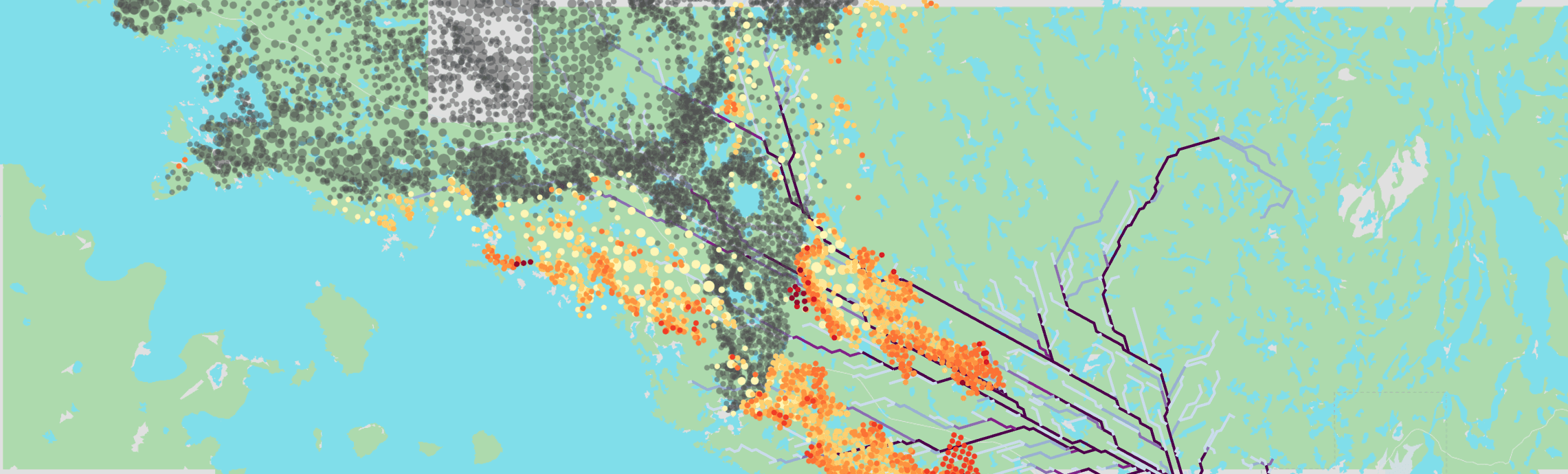
This is an example of what fire corridors look like with M3 hotspots overlaid. This is the Yellowknife corridor data with 2023's hotspots.